HOW I WAS ALMOST KICKED OUT OF GRADUATE SCHOOL. OUCH!!

The following essay is a tiny bit technical in a way that geologists will readily understand but readers without a background in earth science may stumble over. Yet there is an easily understood general lesson about science and how it may be advanced by research projects. I hope I haven’t turned off some potential readers with this intro.  A slightly edited version of this story was published in the  April 2013 issue of EARTH MAGAZINE. 


THOUGHTS ON A GRADUATE THESIS PROPOSAL

OR

HOW I ALMOST GOT BOOTED FROM GRADUATE SCHOOL

By Wendell A. Duffield


As a ripe old septuagenarian, as the author of a fairly respectable record of published research results during a four-decade career in geology, and as a person currently basking in the comfortable position of a financially secure retirement from which only failing health or death can disrupt or dislodge me, I am now ready to share a graduate-school experience that might have short circuited the publications and retirement messages in the introductory phrases of this long sentence. Perhaps this essay will be of some use to present-day geology students aspiring to obtain MS and/or PhD degrees.

            My graduate-school setting was the high-octane Department of Geology at Stanford University. Fueled with hope and enthusiasm, I arrived there in the fall of 1963 toting a Bachelor’s degree, with major in geology, issued earlier that year by Carleton College of Northfield, Minnesota. At Stanford, I was ready to begin scaling that one last rung on the academic ladder, which raises one to the lofty heights of a PhD. With that sheepskin in hand, I supposed I would be able to secure an intellectually challenging, physically exciting, and financially rewarding job in academia, industry, or government — perhaps with a focus of my own choosing. Back during the 1960s, jobs in geology were looking for people, rather than the other way around of more recent times!

            I spent the first two years at Stanford in classrooms studying a variety of geology topics required for all of us new PhD candidates. During year two of that period, each of us had to develop a proposal for an independent-research project, which would be the core of satisfying PhD requirements. Typically, four years in grad school would suffice for earning a PhD.

My proposal, like those of my graduate classmates, was supposed to demonstrate sufficient evidence that its author had the right stuff for designing, carrying out, and then publishing a scientifically sound project in peer-reviewed geologic literature. Permission to continue on the path to a PhD depended on successfully explaining and defending the proposal before a panel of faculty critics. Members of my panel were an assigned advisor (a specialist in igneous petrology) plus three geology professors with other backgrounds.

Having come from the southern part of Minnesota where the surface geology is mostly the drab sand, gritty gravel, bulbous boulders, mud and clay of Pleistocene glacial deposits, interrupted by some colorful coarse-grained Precambrian bedrock granite locally peeking through the young non-consolidated blanket, I had chosen to be what is called a “hard-rock” geologist, which has nothing to do with one’s preferred genre of music. I simply wanted to study rocks hard enough to sing back when struck with a geology hammer.

During spring break of the second grad-school year, I ventured about twenty-five miles into northern Baja California, Mexico, and located a well exposed pluton, which had never yet been the subject of a focused geologic study. The outer contact of the body was obvious, even to a little-experienced field mapper like me. And the roughly one-hundred square miles of surface area were adequate for my field work ambitions. So, this oval-outlined igneous plumb was mine to pick for a thesis area! I would be the first geologist to map the internal features of what I named the El Pinal Tonalite, after a local rancho. I planned to eventually explain this tonalite’s role in the story behind the mountainous Mesozoic batholitic spine that crosses into Mexico from southern California. Or is the crossing from Baja California into Alta California? Rock formations do not recognize political boundaries.

D Day arrived. I felt well prepared with my proposal. The defense began smoothly, as I explained the where and what of my field area to the committee. In- like-Flynn, I mused to myself as the first hour or so of the big event flowed by without an upset.

Then an unanticipated series of questions from the structural-geology professor of the panel suddenly shattered my self-satisfied inner calm. Distilled down to a single notion, he wanted me to describe exactly what single critical question related to a large igneous intrusion I would answer through my research. He framed his query in several different ways as he tried to extract an acceptable answer from me. I thought I was responding adequately to each of his new angles, but ……

But I wasn’t making any progress in our tete-a-tete. The other panel members watched and listened quietly. None of them was about to rescue me from my dilemma. Finally, in the confusion and frustration of an inexperienced young geology student — one could even say, a small-town country kid not long from the farm — I blurted forth that I was going to carry out my proposed research project “…. so I can get that PhD and then land a good job.”

A palpable silence immediately enveloped the room. One could have heard the proverbial pin drop, perhaps even onto a deeply carpeted floor. And then my thesis advisor asked me to leave. I fidgeted nervously in the hallway for several minutes, hearing raised voices through the solid oak door, until he joined me and said “Yes, you will be permitted to continue on the path to a Stanford PhD. But understand that more than one panel member was quite disappointed in your attitude about the value and significance of the PhD degree. Not all votes were thumbs up.”

Whew!! So finally decades later, here I am to share a lesson learned back then — a lesson that I’ve carried with me ever since that stressful grad-school experience and what followed with my independent PhD study. There’s a lingering quandary.

Should a PhD thesis proposal in geology be focused on answering a specific, and perhaps very narrow, question that is posed in advance of beginning any pertinent research? Or should a proposal be cast broadly enough that a researcher might discover information that could help answer multiple unanticipated questions and perhaps even illuminate entirely new questions that would emerge and beg to be explored further in mid-stream of research?

I accept a valid place for both paths in scientific research — a spectrum with end points that I call DISCOVERY and VERIFICATION. A research proposal based purely on discovery need have no specific advance plan, just a desire to study some situation to see what gives. Whereas research based solely on verification might simply work to further solidify a fairly well established hypothesis. Both avenues can advance our science.

My structural inquisitor of 1965 preferred the narrower approach to research, while I simply wanted to map, sample, and then deconstruct those samples to characterize the El Pinal pluton in as much detail as I was then capable of. I figured my hand-selected rock samples and their internal stories would lead me to answer questions about that pluton, and perhaps similar igneous intrusions, without any starting bias carried by an expected outcome.

Ironically, once the veil of mystery was pealed back by field and lab studies, I discovered that my thesis was fundamentally a study in structural geology. Neither I, nor my advisor, nor my structural geologist inquisitor would have predicted such an outcome in pre-fieldwork planning. By covering the ground on foot, collecting oriented samples to be studied with a universal-stage-outfitted microscope and thereby making many measurements of structural features both large and small, I discovered that the systematic orientations of platy plagioclase grains, elongate hornblende crystals, and flattened mafic inclusions together define a concentric pattern best explained by originating from the upward streaming of magma into a roughly six-mile diameter zone around the core of the pluton — a zone that likely represents the roots of a ring dike. This ring dike might even have served as a passageway for magma feeding a volcanic eruption of caldera proportions. Any erupted magma to test that possibility would have been eroded away long ago. If you’re interested, you can read about this story on pages 1351-1373 of the Geological Society of America Bulletin, v. 79, published in 1968.

If there’s a common thread that ties together my post-thesis career in geology, it’s that many El-Pinal-Tonalite-type surprises can be expected, in spite of well thought out project plans. Students take heed, and as the BSA motto advises, “Be prepared!”


AN EXPLOSIVE STORY ABOUT A LAVA LAKE AT KILAUEA’S MAUNA ULU VENT

The following essay relates a true tale of young volcanologists who thought they might be able to tweak, and maybe even temporarily control, the Natural volcanic behavior of a large lake of molten basalt. I leave it to readers to decide if we were foolish, reckless, pace-setting, or ???? when we carried out our lava-lake experiment.

An Explosive Story about a Lava Lake at Kilauea’s Mauna Ulu Vent

Wendell A. Duffield

2013

A video recently posted at youtube  (http://www.youtube.com/watch?v=kq7DDk8eLs8) rekindled memories of my part in trying to trigger lava fountaining at an active lava lake within the crater at the Mauna Ulu eruption site on the East Rift Zone of Kilauea Volcano. The time was early 1971, and the cast of characters for the somewhat furtive experiment in “volcano control” included staff members of the U. S. Geological Survey’s Hawaiian Volcano Observatory (HVO).

The youtube video shows what happened in 2002, at the lava lake in Erta Ale Volcano’s crater in northeastern Ethiopia. When the accumulated human trash of a camped-out crew was tossed onto the thinly crusted-over lake of molten basalt (a convenient incinerating garbage disposal), it broke through the crust and triggered a brief spate of meters-tall lava fountaining.

Thirty one years earlier, the condition of a lava lake in the crater at Mauna Ulu was similar to that in the video of Erta Ale. The HVO staff spent many days watching this thinly-crusted-over lake of molten basalt go through what we called a repetitious gas-piston cycle (For details see U. S. Geological Survey Professional Paper 1056, published in 1979). Over periods of a few to several minutes, volatiles (probably mostly water vapor plus a bit of carbon dioxide and sulfurous gases) exsolved from the lava, lifting the overlying thin solid crust as they accumulated beneath it. These volatiles eventually burst violently through when their vapor pressure exceeded the strength of the crust. In effect, the lid flew off its carbonated (and the other volatiles) beverage! A few minutes of low-level lava fountaining ensued, releasing the accumulated volatiles. Then the crust quickly healed itself, and another gas-piston cycle began. All of this occurred below the level of the crater rim. Incidentally, between the fountaining episodes, pieces of the crust moved about relative to each other in a miniature version of global plate tectonics. You can read about that story in the Journal of Geophysical Research, 1972, v. 77, no. 14, p 2543-2555.

        F49a_Duff

 The crusted-over lava lake in Mauna Ulu Crater, which measures about 150 by 300 feet.

After safely watching the gas piston cycle many times over days and weeks, a childish urge to throw rocks kicked in. Boys and tomboys know what I’m talking about. We began to hurl in chunks of solid rock from our perch at the crater rim, as we watched lake crust rise toward its eventual natural demise. And we quickly discovered that we could trigger pre-mature volatile-driven fountaining as our missiles penetrated and broke up the thin cover of crust.

It seems that some of us PhD-toting guys (no females were on the science staff at HVO back then) were still adventurous boys at heart. We soon replaced the rock missiles with containers of water in hopes that by adding to the volatile inventory (liquid water instantly flashes to vapor as it becomes immersed in the 2,000 degree Fahrenheit lava) we would be able to trigger fountains more vigorous than the natural ones. We began with one-gallon thin-plastic containers and eventually ratcheted up to a five-gallon size … the maximum weight that we could safely lift and throw over the crater rim. Alas, even five gallons of added water-flashed-to-vapor failed to produce visibly higher or longer-lasting fountains.

So, as any thorough scientific experimentalist would do when initial attempts fail to produce an expected result, we decided to use a more powerful additive. We built a thin-walled cylindrical metal canister and filled it with the type of explosive used by seismologists to create man-made earthquakes. We adjusted the specific gravity of the overall package to sink just a few meters into the lava lake before detonation (triggered by an appropriate length of a fuse of known rate-of-burn). We spanned the crater with a steel cable positioned around a pulley at each end of a loop. The top of the explosive-filled cylinder was attached to the cable by vice-grip pliers, which could be tripped open to drop its suspended load by tugging on a wire line attached to the pliers handle. With all systems ready to go and tested (sans explosive), we ran the experiment.

Cautious members of the team chose to watch from the relative safety atop a nearby prehistoric cinder cone. The view was downward toward the Mauna Ulu crater rim, but not enough to see the surface of the lava lake. Braver team members stayed at the crater rim to light the fuse, cable the package to the center of the crater, and pull the release wire for the vice-grip pliers. They then fled, for the possibility that our experiment would trigger fountaining vigorous enough to overtop the rim. So none of the team saw what happened when canister penetrated lake crust.

We waited long enough to feel confident that our explosive package was dead, before gathering back at the crater rim. All we saw was a typically thinly-crusted-over lava lake midstream of a gas-piston cycle. That marked the end of our tinkering with the Natural state of affairs. I suppose all we accomplished was to contaminate a pool of pristine molten basalt.

I’ve since often wondered what the interpretation would be if a future geologist happened to sample that batch of lava and discovered a bizarre chemical signature. Ditto for any sample contaminated by the camp-site trash tossed into the Erta Ale lava lake.

THE STORY OF GRAND FALLS IN ARIZONA

Image

Twenty thousand years ago, a volcano erupted very fluid basalt lava about 35 miles east of Flagstaff, Arizona. That lava flowed several miles further east, where it spilled into the deep narrow canyon of what would later be named the Little Colorado River. Lava totally filled the canyon and spilled over to the far side a short distance. Eventually, water filled the newly created upstream reservoir, found its way around the edge of the far-side lava spill-over, and cascaded into the downstream part of the canyon on its trip to join the Colorado River. Today, that cascade is called Grand Falls. The vertical drop is that of Niagara Falls, although Grand Falls flows only ephemerally, as spring snow melts or as summer monsoon rains pour.

In May of 2003, I led a field trip to Grand Falls for 6th grade students from DeMiguel School of Flagstaff. At the end of my show-and-tell, the teacher, Rosemary Hume, asked each student to write a short essay about what they learned from the trip. I joined the students by writing the following poem.

The Story of Grand Falls

By: Wendell A. Duffield

2003

First came the canyon, so deep and so wide.

Water ran through it, with plants on the side.

Then came the lava, real runny and hot.

It spilled in the canyon and filled up the spot.

Next came erosion that washed rocks away,

To make a new canyon that we see today.

Finally came students to study this stuff,

With help from their teacher

And a geologist named Duff.


THE QUESTION OF EARTH’S HUMAN CARRYING CAPACITY, REVISITED

The September 13 issue of the New York Times carries an Op-Ed essay titled “Overpopulation is not the Problem” by Erle C. Ellis. Ellis writes that there is no limit to Earth’s human carrying capacity. He’s of the ilk that believes that technological innovation will keep pace with whatever the human population growth puts on Earth’s surface. I emailed him the following questions.

1) What will the “solution” be when the surface of Earth is covered by living human bodies … maybe even covered in multiple vertical layers? Where does food grow then? Do we start eating each other?

2) Your essay includes the phrase “… the last ice age …” I presume you actually mean the most recent ice age. There have been many in the past, and I can think of no reason that there will not be more in the future. Do you deny this possibility?

3) Which brings me to this question. You write about the “Anthropocene”, a geologic term, but at the same time you ignore geologic time (sometimes called DEEP TIME in recognition of the 4.6 billion year age of Earth) and events that have and likely will continue to impact the planet. One literal future impact could be of the sort that wiped out so many lines of plants and animals at the end of Cretaceous time. Wouldn’t such an event limit the Earth’s human carrying capacity, likely wiping out Homo sapiens?

It’s uplifting to believe that Homo sapiens are smarter at sustaining themselves than natural forces are at limiting such sustaining. I doubt that such is the case.

Wendell A. Duffield

Thumbs Down on USA Exceptionalism …. A Personal Opinion

It seems that the noun exceptionalism and its adjective cousin exceptional have fully infiltrated the vocabulary of national politics and news media. Though he earlier was hesitant to use either word to describe our country, saying that many other nations undoubtedly consider themselves to be exceptional (he took a lot of political heat for saying that), even President Obama now embraces the use of such language to describe the USA. I take exception (pun intended) with the notion of USA exceptionalism for two reasons.

Reason 1: In an array, the exception is the oddball. Carrying this oddball distinction may be a plus, if the rest of the array is somehow relatively lacking in a desirable trait.  Or it is a minus when such a trait is undesirable. It’s all quite subjective. Obviously, our very patriotic politicians are certain that other nations are relatively lacking the greatness traits of the USA, presumably as measured by universally accepted standards in their opinions. This is such an oversimplification that I classify it as political theatre rather than intelligent thought. [As an aside, I lived in France for a year in the 1970s and was repeatedly told by French friends and professional colleagues that the USA motto is “Bigger is Better”. This was not said as a compliment. Though the young professional I bristled a bit to hear this talk back then, I have mellowed enough with age to think the version of this notion, as heard earlier, applies to so many of our current politicians, media folks, and activist citizens today.]

Reason 2: Believing that our country is exceptional in a positive sense is a personal opinion that any citizen is entitled to hold. I agree that many USA traits are positively exceptional. But our fellow citizens who travel around the country and the world spouting the all-inclusive notion are so exceptionally arrogant that they reflect poorly on our national and individual characters.  Even just a bit of humility might make the world a more peaceful and safer place for living.

A KILAUEA LESSON FOR LOVERS

This essay is a warm mixture of fact and fiction. Those who know how Kilauea was behaving in the late 1950s will be able to separate the two. For other readers, I hope the tale is inviting without being familiar with all the back story information. Just remember that living on Kilauea is a bit like life on a waterbed, only the water is magma and the bladder container of the fluid is a pile of lava flows.


                             A Kilauea Lesson for Lovers

By Wendell Duffield

2013

The inbox of my personal email recently beeped the arrival of a rather intriguingly mysterious file whose title links the pulse of a well known Hawaiian volcano with that of human lovers. With much trepidation I opened that file, fingers crossed that its access to desk-top circuitry would not corrupt my HP Pavilion. The professional pull generated by having studied the titular volcano during the early years of my career in geology was stronger than my resistance to possibly triggering yet another digital crash-and-burn caused by self-centered curiosity.

Having now read and pondered the mysterious message about Kilauea, in hindsight I know I made the correct decision with the left click of my mouse. The file verifies a behavioral link that I have long felt between my first volcano and my conjugal life.

I wish to share the story with other lovers of volcanoes and lovers of, well, love. The use of pronouns replicates the tale as sent to me. No names were attached. The message apparently represents the recently typed hand-written notes of a geologist who was part of a team that studied Kilauea long before small portable computers served science. The story describes early years of research at the Hawaiian Volcano Observatory, popularly known as HVO. It reads like a personal diary. The action described began in 1958, while I was still in high school.


November 15, 1959: It’s 4AM, and I’m about to grab a couple hours rest from our frantic scramble to keep tabs on a mega eruption that began last night. But before sawing some wood, I’ll jot down a few notes about this big event. It all began last year.

A master key to getting a firm grip on what was happening underground, down in the bowels of Kilauea between eruptions, was turned during the autumn of 1958 shortly after the staff here at HVO finished installing an array of seismometers across the summit area of the volcano. From then on we’ve been able to record the seismic shakings and tremblings of the mountain and use those data to map the hypocenters of quakes that originate within the heart of Kilauea. No more guessing about the where and what of these temblors’ origins!

Suddenly, we were able to reasonably surmise a long history of periodic violence that we had suspected from interpretation of the badly broken surface lavas of Kilauea. Over time, the internally generated grumbling and rumbling of earthquakes has literally busted up the volcano. We had no big surprise there.

But here’s what showed up as a kicker surprise with our newly installed recorders at Kilauea. One unique type of ground shaking produced an entirely unexpected shape of tracing on the Observatory seismograms.

We were initially dubious about the meaning of the pattern. Maybe there was something afoul with the electronics of our machines? That was said to be very unlikely, by our electronics technician. Multitudinous bursts of the bizarre pattern were recorded repeatedly over a period of days to months, from 1958 to the day I write these words in 1959. Eventually, we cautious scientists bravely (ha!) concluded that we were seeing a truly new expression of Kilauea’s inter-eruption unrest.

The new seismic tracings came with no human-felt shaking of the ground. They apparently were the result of a far too weak and subtle force for that. Yet they were mind bending … and boring. Mind bending, because they were unique in seismic history. (And all of us research scientists know that we live to discover new things about nature!) Boring, because they went on and on and on, with absolutely no variation in the shape or frequency of their paper-chart trace. We were dealing with one-cycle-per second monotony. One staff joker described this unitary hertz as a foreign thorn in our collective side, Hertz being a German scientist for whom such repetitious cycles are named.

Our hertz was a constant-amplitude wave form … up and down and up and down etc … somewhat like a pond-surface wave generated when a rock is thrown in. But those pond waves quickly die out. So does the wavy pattern generated on seismic charts by the ground shaking during a conventional earthquake.

Several staff meetings aimed at developing a scientific explanation for our discovery ended in frustration. All we could agree on was to call the new thing Harmonic Tremor. But then just yesterday the amateur church organist (our geochemist) interrupted his customary low humming of hymnals with a “Eureka! I’ve got it!!” shout.

“Team,” he said. “I think that we’re recording the pulsing flow of magma rising through Kilauea on its way to eruption. It’s playing a tune for us, just like air does when it surges through a pipe of my church’s organ. I think that unusual magma-generated signal may be able to tell us where and when the next eruption will happen. All we have to do is chart the depth where the pulsing originates and map the bulls-eye spot at Kilauea’s surface that the rising pulse is aimed at! We’ve got a monotone guiding us on its way to giving life to a new layer of surface lava!”

During his Eureka moment, I scribbled notes.

Then, with a shared feeling of a possible major scientific accomplishment, we dispersed late that afternoon (Hey that’s just yesterday. It seems a lot longer ago.) and headed home to our families while the tremor of good old Johnny one-note continued to saturate our seismometers.

My wife had prepared a tasty mahi mahi dish for dinner, which we savored as I explained the professional excitement of the day. She nodded her approval of my enthusiasm as I talked about earthquakes and the newly named harmonic tremor that was shaking our seismic instruments at one wave-cycle per second. “That’s one hertz in professional talk. Named for … you probably already guessed it … a German scientist named Hertz. That’s spelled h e r t z” I added, knowing that she would mentally file the pronunciation and spelling of that word in her growing vocabulary learned from a husband wedded to his career nearly as much as to her.

Later that night, perhaps in part a result of more-than-adequate white wine with the mahi mahi, we made gentle love that generated a steadily sloshing rhythm in the liquid bladder of our waterbed. As we finished and lay supine in parallel exhaustion, she whispered, “Aaaah.  I love that love …  that hertz.”

I glowed in the satisfaction of knowing that her closing word was not its painful homophone. We dozed off mutually content.

Shortly thereafter, a phone call informed me that Kilauea had begun to erupt … at about the time that my love and I had slipped between the sheets. The volcano’s harmonic tremor that our team had named, interpreted, and seen recording during yesterday afternoon’s discussion had indeed represented the rise of molten rock. And that hot sticky fluid is now spurting into a deep pit crater called Kilauea Iki.

I feel a closer-than-ever bond with both wife and the current object of my career. Life is good! Fantastic!!


Well readers, there you have it. An unusual tale that links love of science to love of human life. Whoever the anonymous sender of the email is, I heartily thank you. You rekindled memories that I shall never forget, of my 1970s days on the staff at the Hawaiian Volcano Observatory. Perhaps your diary contains other intriguing messages? You know my email address.

MY EARLY ADVENTURES IN BAJA CALIFORNIA, MEXICO

A SPANISH LESSON IN TIME

Helped Me Translate a Clever Rhyme

Wendell Duffield

August 2013

 {I hope readers of this essay won’t be put off by the truly cutting nature of its punch line. As a kid who grew up with all the activities of a typical family farm of the 1940s, this kind of cutting (sometimes accomplished by knife and sometimes by rubber-band constriction) was part of the annual cycle of animal life. And as a human who is aware of the macho image that males of our species often project, I can appreciate the back story that gave rise to my language lesson in Mexico.}


 When I was a geology graduate student at Stanford University in the mid 1960s, the successful candidate for obtaining the PhD degree was required to demonstrate moderate proficiency in two foreign languages. Although the level of proficiency in the one-and-only foreign language I brought with me to Stanford was well above moderate, Latin was not accepted by the Geology Department. Lack of pertinent geologic literature in that tongue was the purported reason, although naturalists of the Roman Empire wrote many learned treatises about rocks and such centuries before Leland Stanford even thought to honor his son by establishing a top-notch university named for that lad. Sigh!

One of the early Roman scientists, who unfortunately witnessed the 79 A.D. eruption of Vesuvius at a lethal distance, would have the explosive style of that and many similar eruptions elsewhere named Plinian in his honor. But though I was on an educational track that would eventually lead me to study many Plinian volcanic deposits, my Latin was still not up to Stanford standards. So, I enrolled in one-semester crash courses of German and Spanish. These were specifically designed to help graduate students like myself successfully clear the language hurdle. And they served that purpose for me and my classmates.

Within a few weeks of the course’s termination, I forgot virtually all of the German that helped me jump the deutsch hurdle. But serendipitously my PhD thesis field area was in Baja California, Mexico. And in the lead up to my first south-of-the-border field season of mapping and collecting rock samples for lab studies, I practiced my rudimentary classroom Spanish through tapes and books, and by talking with Perfecto Mary, the Geology Department’s rock-lab expert. Sẽnor Mary was a native of Spanish-speaking South America. Our conversations were brief and quite repetitive. All these years later the one sentence I remember was his daily plaint “Tengo mucho trabajo, pero poco dinero” followed by loud resounding laughter. Still, the inflections and cadence of his speech helped trained my ear for a relatively clear comprehension of what were strange sounds for someone who had never before been out of country. My only previous exposure to Spanish came from watching TV shows of the Cisco Kid.

So armed with the sad story of trabajo and dinero, plus several other handy phrases mostly about the weather and such trivia, I drove south into the back country of Baja alone. I set up camp, a tent that served as home and office, forty miles south of the Mexican border town of Tecate (beer drinkers should recognize this name) at the middle of a extensive body of igneous rock, which I was to study. My only human neighbors within a several mile radius were Sẽnor and Sẽnora Amador and their fourteen children. The oldest child, Domingo, was forty. His name would be assigned to the first cat that my wife and I would soon adopt back in Stanford student housing. The youngest Amador was four. Obviously the father of this brood was quite the amador, with living evidence of considerable fertility and staying power.

The family welcomed me onto their cattle-ranch land. I often encountered a couple of the older vaquero male children (who were much older than me) during my daily on-foot traverses across the landscape as I mapped and collected rock samples. Our conversations were necessarily brief and mundane. They knew no English and my Spanish was still rudimentary. So talk was limited to hello, how are you, nice weather and such. Then they would trot away on their caballos as I hefted my rock-filled backpack. The Amador family and I parted ways at the end of that first field season with embraces and my clumsy attempts to say that I would return the following summer.

Back at Stanford I continued studying Spanish through tapes, books, and conversations with Perfecto Mary. My vocabulary expanded beyond weather and how-do-you-do. I began field season two with confidence of perhaps meaningful conversations with my Mexican friends.

Be patient. I’m getting to the punch line of this tale. It came on a day when I met Domingo and Eugenio, the next-to-oldest son, during one of my rock-collecting cross-country traverses. Remember that they knew me as a young adult living alone for weeks and weeks and weeks. As they broached that day’s topic, I sensed their puzzlement of the fact that I hadn’t yet visited two similarly lonesome young sẽnoritas who lived at a neighboring ranch. After a couple of repetitions, I came to realize that they were asking why I didn’t seek out some female comfort, or whatever their words were to express this idea. I knew what they meant. They were two of fourteen products of the topic being explored.

Wanting to impress my friends with my use of their language, I silently recalled that the Spanish verb estar (to be, in English) generally carries a connotation of uncertainty. By contrast ser (also, to be, in English) carries a connotation of certainty. So I proudly announced “Soy casado!” hoping to have said that I was married and indeed I intended to truly stay that way. My pronouncement triggered high decibel laughter.

In loud unison came their rapid boisterous rejoinder of “Pero no capado,” again followed by raucous laughter.

And I got it. My vocabulary included a verb whose English translation was a significant part of my childhood upbringing on farms. So we all had a good laugh.

When I arrived back at Stanford where my wife Anne held forth, I related the entire tale. And of course I emphasized the reason for my use of the Spanish verb ser!

Wild Field Work on Molokai Volcano, Hawaii

Fieldwork in the tropics can be challenging for geologists. Something as simple as finding exposed rocks to study is not a given in a landscape covered with lush vegetation. Well, here’s the story of one such adventure.

Geology Adventures on Molokai Volcano, Hawaii

Wendell Duffield

2009

            In 1975, Keith Howard, Mel Beeson and I (all U.S. Geological Survey geologists) had a fieldwork adventure on the island of Molokai, Hawaii, that none of us will ever forget. We were headquartered in Menlo Park, CA, at that time. Mel was in the midst of studying the chemistry of the 1,600-foot-thick section of lava flows exposed along the foot trail that descends to Father Damien’s well known leper colony on the Kalaupapa Peninsula of Molokai. I was mapping volcanic rocks here and there in California. Keith was plugged into the USGS program of Astrogeologic Studies. Somehow he convinced his money managers that one could learn a lot about the geology of Mars by studying the caldera of East Molokai Volcano. The three of us … young, enthusiastic, and in search of adventure … teamed up to do so.

            February 4: A helicopter ferried us and our equipment into this very remote rainforest area. The pilot assured us that he would pick us up three weeks later. As our last glimpse of “civilization” for those coming weeks choppered out of sight, we made camp, filled with energy and grand expectations of improving the pioneering geologic mapping done in the 1940s by Harold Stearns and Gordon Macdonald.

            We began in Wailau Valley, a deep north-flowing drainage carved into the east flank of the volcano. We quickly discovered that lush tropical vegetation hid virtually all bedrock. Desperate to put our geology picks to use, we shed our clothing and swam streams to the few rocks that peeked through greenery. By day eight of nude fieldwork, we were very discouraged by the paucity of real rocks. And almost worse, by then we were completely bummed out by our victuals.

            Keith had purchased a pallet of surplus military K-rations, as our sole source of nourishment. They were light weight, highly caloric and the price was right. But with only four different meals, we soon ate solely to stay alive. Adventuresome Keith tried snails from Wailau Stream and raw taro root. Ugggh! Smart Keith was a one-trial learner and went back to K-rations.

            Hoping for better outcrops, we headed west into Pelekunu, a deep valley eroded across the caldera of East Molokai Volcano. Getting there was a two-day seemingly life-threatening adventure. What we had been told in advance would be a well marked trail, definitely wasn’t. Nonetheless we found Malihini Cave, the bedroom target for our first night. We slept outside in the rain though, rather than on a cave floor covered ankle-deep in goat poop. Next day we crested 3,000-foot-tall razor-back drainage-divide Kolo Ridge, and stumbled more than walked down to a USGS stream-gauging-station shack where we found a meal’s worth of Spam … Yummy!!!

            Field traverses in Pelekunu Valley verified what we had discovered on the first day in Wailau. Most of the landscape was covered by ferns and grasses and bushes and trees. But along some stream banks we found outcrops of dike swarms and hydrothermally altered lava, presumably parts of the guts of the caldera. Other enticing outcrops stared down at us from inaccessible tall cliffs.

            And of course at one of the planet’s wettest places, it rained and rained and then rained some more. We entertained ourselves during down times by carving Hawaiian flutes from sections of bamboo and trying to make music. For variety, we gathered the pea-sized shiny off-white seeds (called Job’s Tears) of a tall grass and strung them into attractive necklaces. Thirty-four years later, I still have my Job-Tear creations and am wearing one of those necklaces as I type these words. But with each passing Pelekunu day, rain or not, we were getting sicker and sicker and sicker of K-rations.

            In semi-desperation for dietary variety, Keith and I went on the bare-handed hunt for one of the many feral pigs that thrive in Hawaiian rainforests. We caught one, about a thirty pounder. The three of us gathered, catch in hand, and salivated until we realized that we didn’t have the heart to kill the little porker. The fact that piglet was crawling with lice was another deterrent to slaughter and feast. It was to be K-rations to the end, other than the fruit of a banana tree we found near camp.

            February 25: Our escape helicopter arrived on schedule and deposited us at the Molokai Airport. A wiki wiki cab took us to a hotel in Kaunakakai, the island’s main town. My wife Anne, who normally is terrified to even get near an airplane, had flown in from the mainland to greet me. I paused long enough to plant a cursory kiss. Then we all headed to the nearest café, where Keith, Mel and I overate. Next morning, as Anne and I awoke in a warm embrace, my first words were “I’ve been dreaming about an apple turnover.” Later that morning, back at the café, Keith, Mel and I ate two full breakfasts each. To this day, Anne likes to teasingly remind me of how much more interested I was in food, than in her, during our Kaunakakai reunion.

1975 Mar. Duff tooting his flute1971 Aug. Mel banana harvestKeith-piglet-Duff

Duff Playing his hand-carved flute                         Mel with bananas                          Keith, Duff and Piglet

Source of the Mississippi River Revisited

This version of the essay is told as a conversation with my college classmate Mike Freed, in order to appeal to other classmates at our recent 50th reunion. A more technical version exists and is in search of a publisher. Both versions tell the same tale.


Image

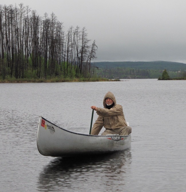
Mike Freed paddles toward exciting discoveries.


Old Men and Rivers

By:  Wendell A. Duffield

January, 2012


Ask almost any knowledgeable Minnesotan where the mighty Mississippi River begins its 2,300-mile journey to the Gulf of Mexico and the answer will be, “At Lake Itasca, up in the northern part of our state.”

Itasca is one of the ten thousand lakes that decorate and submerge much of Minnesota. These lakes are bodies of water left behind as the melting snout of North America’s most recent glacier retreated towards its Arctic origins around 12,000 to 10,000 years ago. They’re recharged today by seasonal rainfall and snow melt. Though a member of such a very large family of lakes, Itasca has a small footprint (about 1.5 square miles) and shallow average depth (about 30 feet).

But Itasca’s fame is broad and deep. A modest breach in its north shore is where ten thousand and more visitors are said to have walked across the birth bed of the Mississippi River on a few properly human-positioned stepping stones, without getting their feet wet. A dry crossing is a sort of unofficial rite, an initiation to become a certified resident of Minnesota. Should someone slip and wet a foot or more, rules of the rite allow multiple attempts until success is attained. Only an inept or unable person would fail. And as Garrison Keillor repeatedly points out, so many Minnesotans are above average.

I’m one of the many initiates who succeeded at first try. I was six years old at the time I passed muster, with legs barely long enough to jump from stone to stone at the crossing. My mother recorded the event with a black-and-white snapshot, eventually lost in the chaos of the family-house attic. A lot of water has flowed down the Mississippi since then.

Now as a septuagenarian who was tossed by the rapids and spun in the eddies of formal education for two decades, followed by nearly a half century of navigating the experiences of a professional in the sea of geology, I find myself doubting that Itasca is the source of North America’s greatest river. This doubt has sprouted not from naiveté, but rather from earth-science factors that don’t fit into the popular Itasca scenario. And it continues to grow with time. I’ve concluded that all of us initiates to date may have been bamboozled by the Itasca tale, which is told as gospel to children before they are educated enough to be critical thinkers. As a concerned adult research scientist, I feel an obligation to publicly question traditional evidence of the river’s source before new generations of kids might be misled.

For the past few years, I’ve voiced my doubts to many listeners. And by speaking out, I’ve discovered how passionately adherents to the Itasca story do not want to hear an alternative view. Questioning of this oft-repeated “truth” seems to be equivalent to dissing one of Christianity’s Ten Commandments. Once chiseled into stone and sermonized over generations, such rules accrete a protective coating of question-proof armor for believers.

But I stubbornly persist. “Wait! My story holds as much water as that lake from which you believe the Mississippi River flows,” I explain to those who listen, but then react as if I’m attacking their sanity. “Just consider these facts, backed with scientific principles of …”                                                                                                                                                                                                                                                    

Before I can finish the sentence, derisive sounds drown out the information I want to explain.

Discouraging? Yes! But recently I unexpectedly encountered an independent human source of evidence that calling Lake Itasca the Mother of the Mississippi may indeed be a shaky, if not a false claim. And I’ve decided to write his story in hopes of reaching readers who are open to new ideas — people who might acknowledge that I’m not a wild-eyed heretic out to dash a Minnesota legend.

Allow me to introduce my college classmate, Michael Freed. Mike is an exceptional person whose curiosity seems unbounded. He’s a sponge looking to soak up information, simultaneously refusing to accept a new concept as valid without testing it himself. He also seems more interested in educating himself than helping to educate others. Selfish? I think not. He just wants to learn as much as possible before his mind begins to atrophy under the debilitating stress of time.

Having neither seen nor heard from Mike since graduating from Carleton College in1963, we two happened to reconnect at a recent class reunion, where he told me his take on the Itasca claim. So here’s his story. Read, open your mind, and see what you think. If you decide it’s malarkey that needs protesting, please contact Mike, not me!


A Conversation with Michael Freed


During an evening on-campus gathering of the class of ‘63 in one of the college’s new apartment units, Mike coaxed me to a quiet corner of our meeting room, relatively free of the noise from inane palaver of our classmates.

“Duff,” he began, as though I had expected to hear from him that night. “I’ve heard you say that Itasca isn’t the source of the Mississippi. I was at one of your geology talks open to the public.”

“Really?” I said in surprise. I’d been giving these lectures as a volunteer for continuing-education organizations. Most attendees were new faces for me.

Mike and I hadn’t been close friends during the college years. My aging memory seemed to remember him as majoring in one of the social (so-called) sciences — a path that allowed and invited multiple “answers” to questions, in sharp contrast to a more rigidly physical science such as my geology major.

“I didn’t see you. Why didn’t you let me know you were there?”

Before he could answer, I sensed the reason for his silence might be that Mike was still a loner. During our college years, while most students had their cliques of close buddies, Mike had been the introvert. In fun, we extroverts referred to him as Mr. Apostrophe, thinking we were quite clever to label him as I’m Freed — freedom being neither wanting nor needing to belong to a social group.

            Mike’s answer tonight was “Cuz during the question period you were mobbed by doubters. I think I was the only one swayed by your tale. And what you said got me thinking about a way to test your ideas. That’s what I want to tell you about now.”

            That focused my attention. I was ready to settle in and listen. A drink would help lubricate the conversation.

            “Want a beer?”

            “Sure.”

            “Hamm’s?”

            “No. Make mine Dos Equis.”

            I retrieved two beers from the open bar provided by Carleton, whose motivation probably was to help loosen the purse strings of potential donors. Then Mike and I sunk into adjacent easy chairs.

“Cheers.” We clinked bottles and drank in toast. “So what’d you do to test my ideas about the Itasca source?”

            His story began with “I took a canoe trip.”

            “Canoe trip,” I echoed. “What for? To paddle up the so-called Mississippi from the Twin Cities to rediscover where Itasca is?”

            “Nope,” came the reply from lips pursed in wry smile. “I put in a couple miles downstream from St Paul, paddled to the confluence of the Mississippi and Minnesota Rivers, and pulled up on the bank — across from Fort Snelling.”

“And then,” I said, inviting him to offer some wise insight about that place.

“Well, then I sat and reviewed info I’d gathered about the spot. I figured that confluence held the key to understanding which of the two rivers deserved the name Mississippi upstream from there.”

            It was my turn to smile, as I nodded in agreement, wanting to hear where the current of this conversation would flow.

“Bottom line,” Mike said, sounding as certain as an experienced CPA. “The present upstream names don’t agree with what the landscape tells me.”

Yes, I silently shouted as I made a fist of my right hand, thumb up, and held it out toward Mike. He was talking about physical evidence, not blind belief.

“I’d guess the names upstream from there are based on home-state politics or some similar blather, more than science.”

He punctuated that comment with two gulps of Dos Equis. I followed suit with Hamm’s.

“What Chamber of Commerce wouldn’t want to claim the source of the Mighty Mississippi as theirs?”

I interpreted that comment as a hint to where Mike’s canoe trip might end.

“Lookin’ upstream from where I sat,” he continued, “I think what’s named the Minnesota River should be the Mississippi. And what’s called the Mississippi I’d call Itasca or maybe somethin’ else.”

He leaned forward, pulled some notes from a hip pocket, and mumbled what sounded like something thousand cubic feet per second.

“I’ve got two reasons to change the names. First one is about the amount of water that each river carries to the confluence.”

This geologist could see that sociologist Mike had done key homework for his canoe-launched discovery trip.

“If flow was a lot more in one than the other, I think it’d make sense for the biggie to be called the Mississippi.”

He harrumphed, put on a professorial look and sound, then added, “The branch of a tree isn’t mistaken for the trunk.”

“Yeah. That seems logical to me.”

“I found information about water flow on the internet,” he said. “There’re seasonal and geographic differences in how much water comes in from upstream, depending on rain, spring snow melt and such. But averaged over a few years, the two rivers flow about the same. So there’s no convincing bigger-is-better argument for the way things are named.”

            “Agreed.” I was hearing part of my own story from a pair of independent lips —  lips of a person not trained in science, but aware of what a mute landscape can tell of its history.

            “Let’s drink to that.” We clicked bottles, swallowed, burped and grinned.

            “Next point,” Mike said. “My second reason for changing the upstream label from Minnesota to Mississippi is kinda complicated.”

            “Go for it. I’ve got all the time you need.” Mike had already made this class reunion a winner. For once I was in no hurry to rush home from boring remember-when conversations.

He checked his notes again, while I fetched pretzels and peanuts from the bar.

            “I’m no geologist, but I took that introductory course back in the day to satisfy a science requirement. I remember Profs Dunc Stewart and Eiler Henrickson telling us that mountain glaciers are like river systems. There’s the main tongue of ice plus smaller tributary branches that feed in from the sides.”

            “Right. So?”

“The glacier ice flows more-or-less like the liquid water — just way way slower.”

            “Right again. So?” I thought I knew where Mike was headed. I wanted to hear him reason it out, rather than coach him.

            “The thick main tongue gouges out a deep valley. The thinner ice of side branches can’t keep up, so they gouge out shallower valleys.”

            “Yeah. But you’re not telling me what that has to do with our river problem.”

            “Hang on.”

            Another swig of beer provided thinking time.

            “When the glacial ice melts and becomes a system of rivers, you end up with a main river in the deep valley, and a bunch of smaller ones that feed waterfalls in from the sides.”

            “You’re a good amateur geologist, Mike. We call those hanging valleys, cuz they’re perched way up there on the sides of the biggie. Think Yosemite Valley with its Bridalveil, Ribbon and other falls spilling in from the sides.”

            We both squirmed, searching for comfortable butt support in old lumpy chairs.

“But I hope you’re not telling me that the river valleys we’re talking about here in Minnesota were carved by glaciers.”

“No. Water did the job. Stewart and Henrickson also taught us that water flowing south from the big North American glacier that was melting back a few thousand years ago created the valleys. And there was a whole lot more flowing down the Minnesota then than what’s considered to be the Mississippi above the Cities today.”

I decided to offer a little coaching in hopes of keeping his story flowing in the direction I preferred.

“Stewart also told you that for those glacier-melt days the Minnesota was called River Warren. And that today’s Mississippi, upstream of the Cities, was so puny that it hardly merited a name, most especially not Mississippi. It couldn’t keep eroding its bed down deeper and deeper as fast as Warren was doing for itself.”

“Exactly. So here’s my point,” Mike said. “There’s a waterfall called Saint Anthony’s where the Mississippi flows through Minneapolis. That’s my evidence for what you call a hanging valley — a small version of those hanging valleys in Yosemite.”

“Yes!” I shouted, drawing brief glances from classmates across the room. “I think the river history in the Twin Cities area is something like that. You’re a heck of a geologist for a sociologist.”

Mike smiled. We both squirmed again, seeking not-to-be-found comfort.

 “Another beer?”

“Sure.”

I retrieved more vocal-cord lubricant. Now it was time to urge Mike upstream with his canoe-trip saga.

“So Mike. Once you decided the Minnesota River should be called the Mississippi, how far upstream did you paddle?”

“As far as I could.” He leaned forward and slowly shrugged his shoulders, arms outstretched — a furrowed-brow expression of pain painted on his face. “That paddling was damn hard work.”

 “What’d you do for food and such?”

“There’re lots of towns along the way. I caught a few fish, too. Cooked stuff over driftwood fires and slept on sandy beaches.

“But here’s the main thing I noticed goin’ upstream. The valley for a lot of that stretch is huge — a few hundred feet deep and up to four or five miles wide. Makes the valley of the so-called Mississippi upstream from the Cities look like a mistake — like a shallow scratch across a smooth surface.”

“Thank River Warren,” I said. “Warren deserves most of the credit for the size of the valley of the Minnesota — and for the valley of the Mississippi downstream of the Cities too.

“Here’s an interesting tidbit for you. During its heyday, the amount of water flowin’ down Warren at its upstream origin was three times that comin’ out of the downstream mouth of the Mississippi today. Just remember, Warren was the outlet for gigantic Lake Agassiz, which kept gettin’ bigger as the snout of the melting glacier retreated northward.”

That was a sobering thought. Time for another swig of beer. Mike continued.

“If you want more description on what it’s like to paddle up the Minnesota, read Canoeing with the Cree by Eric Sev….”

“I’ve read that,” I interrupted.

“Then you know that lucky guy had help with the paddling.”

Another gulp of beer, maybe because Mike was remembering his solo sweat-generating trip. Then.

“About three-hundred miles and several days of sore shoulders later, I had to portage around a small dam where water is fed into the Minnesota, I mean our Mississippi, from the south end of Big Stone Lake.”

“More evidence of Warren’s work,” I said. “Big Stone fills a stretch where Warren eroded its bottom extra deep. The dam’s there to help control lake level for the convenience of folks living along its shores.”

“I understand,” Mike said. “So, now I’m paddling up a thirty-mile-long finger lake whose imaginary center line is the boundary between Minnesota and South Dakota. I stayed right to keep my trip and our Mississippi in Minnesota.

“I loved that part. No current to fight. Good fishin’ too.”

He stretched, flexed his arms and shoulders, and smiled. We crunched a few pretzels and washed them down with a beer chaser.

“I know that lake,” I said. “I fished and swam there as a kid.”

Mike continued. “Then you know that at the north end of Big Stone, the state boundary veers overland, a bit to the left. I stayed right and entered what’s labeled Little Minnesota River on maps.”

He hesitated before a mild venting.

 “Can you explain this to me? Little Minnesota! What sense does that name make? Nobody’s ever called the river stretch between Itasca and Lake Bemidji the Little Mississippi! So why’s this the Little Minnesota?!”

“Who knows! It’s another bit of nonsense about how rivers are named. The system seems controlled by whims instead of logical uniform guidelines.”

“Alright. So you and I agree that when I left Big Stone Lake I was still paddling up our Mississippi. Then, bingo, I’m suddenly in Browns Valley.”

“Yup. My hometown.”

 “I know.” Mike shifted his body around, and formed a gotcha expression that I took as shifting his thoughts, as well.

“Now comes where I part ways with Sevareid and his paddling partner Walt Port. Those two portaged for a mile across a continental divide that runs east-west through Browns Valley, then put into Lake Traverse and headed north, goin’ downstream from there all the way to Hudson Bay.

“But my route from BV took a twist that the Minnesota Chamber of Commerce won’t like if I’m still on the Mississippi,” he continued. “The path of the so-called Little Minnesota swings westward, enters South Dakota, cuts across that side of Warren’s valley wall, and heads off into a Sioux Indian Reservation.”

Mike and I now had our upstream Mississippi in South Dakota, and heading northwest. I kept quiet, to see how Mike would describe what had been some of my home turf while growing up.

“Here’s more naming nonsense,” he said. “I’m now paddling up a river named for Minnesota, but all except its last mile or so is in South Dakota.”

We raised right hands, did a high-five slap of agreement, chewed peanuts and did the beer wash down.

“Another ten miles, and the goin’ got tough. I’d timed my trip for the high water of spring, but banks of the river were closin’ in toward the width of my canoe anyway. I had to pull out and call for help.”

Mike leaned back relaxed, as though his tale was complete, but added “Info from the internet says the river I pulled out of starts near a tiny town called Veblen, another twenty miles upstream. I drove up there to take a look.

“There’s no lake. Just open country where rainfall and saturated ground feed streamlets that join to become our baby Mississippi.”

We settled back into our chairs and audibly exhaled in joint conclusion. We polished off our beers.

“Well, that’s my story,” Mike said. “And now it’s yours if you want it. You seem to like to talk and write. I prefer to keep movin’ and doin’.”

He squirmed. “Speaking of movin’. My bladder needs to.”

Mike stood, made his way across the room and through the door labeled GUYS. Consumption of two beers in one hour creates that kind of need, especially so for us old guys.

I waited. Mike didn’t return. I went to drain my processed beer. Mike was not to be found. Similar to graduation day of ’63, he once again silently disappeared. Mister Apostrophe was alive and mobile.


Later


I heard from Mike, via email, about a year later. Meanwhile, I had dusted off my 1963 ALGOL and discovered that he graduated as a biology major. He had more science in his background than I had thought during our earlier beer-soaked Mississippi conversation.

His email described a recent solo hike along the Great Rocky Mountain Continental Divide from Mexico to Canada. He asked if I wanted to meet and discuss why so many people don’t really understand what a continental divide is. Later, we did meet; that’s a story for another time.

After the river conversation with Mike, I’ve continued talking about the Mississippi and how rivers are named, where people will listen. I suspect I’ve convinced no one of the need to even consider changing some labels in this gigantic North American drainage basin. Even so, I may have enlightened a few listeners about how arbitrary the official naming of rivers can seem. Some readers may remember when part of today’s Colorado River, the part actually in that state, was called the Grand. Pick any two river systems with a main trunk and tributaries, and see if you can define a consistent and logical set of rules for the names.

If nothing else of value has transpired, I think I finally enlightened myself as to why I’m interested in the mundane and somewhat trivial topic of naming rivers. The words old and forgotten are involved.

Old River Warren did nearly all the heavy lifting, that is to say the erosion that plucked and carried rock and silt to the Gulf of Mexico, thereby sculpting the valleys now occupied by the Minnesota River and much of the Mississippi below their confluence.

I can easily imagine generations of awe-struck people back in Warren’s time, watching this almost unimaginably massive river coursing over their lands. There would have been no wading across. One Native American, whose remains are known today as The Browns Valley Man, was ceremoniously buried in a gravel bar of River Warren about twelve thousand years ago, a location perhaps selected out of respect for such a powerful presence of nature. I wonder what that man and his forerunners called the river. And if they could talk to us today, I wonder what they would say about the names Warren and Minnesota and Mississippi.

So far as I know, Warren is the first name to be recorded in printed literature for this drainage track. But Old Warren doesn’t get broad credit and appropriate recognition for all of its work. Bummer! Doesn’t seem fair!! I suspect that other than some geologists, few people know the story of River Warren. The truth is that today’s Mississippi and Minnesota Rivers are nothing more than opportunistic carpetbaggers by comparison!

As a kid growing up in its broad deep valley, I didn’t know about River Warren either. Yet I skied and sledded on Warren’s valley slopes. I hiked and camped within the wooded side rills. I swam and fished in the Big Stone and Lake Traverse dregs of Warren’s huge powerful water. I skated on and fished through their winter covers of ice. At age fifteen, a wet-behind-the-ears certified pilot, I landed my dad’s Cessna 120, solo, on the looking-glass smooth and slippery frozen surface of Traverse. That adventure, too, is a story for another time.

Now that I know your story, I thank you River Warren. You created a magical playground for past and future generations of kids like me to enjoy. You and this old geologist are soul mates in ways that many might not imagine, whatever the official names are for the waters in your valley today.